Safe streets for walking and cycling
![]() The West Yorkshire Combined Authority and our partners want to understand which areas in our region could be improved to help the public travel more easily by bike or on foot, and to provide more space to travel safely while social distancing.
The West Yorkshire Combined Authority and our partners want to understand which areas in our region could be improved to help the public travel more easily by bike or on foot, and to provide more space to travel safely while social distancing.
Our interactive map will allow you to highlight issues that you are experiencing when travelling by bike or on foot and to suggest where improvements could be made to make these journeys safer, including increasing space for social distancing. The map can be found here.
You will need to register a username for a login, if you want to add information. There is a link on the map page, or click here.
![]() Take screen shots from google street maps to add to your locations – it will help people to see the true nature of road safety issues.
Take screen shots from google street maps to add to your locations – it will help people to see the true nature of road safety issues.
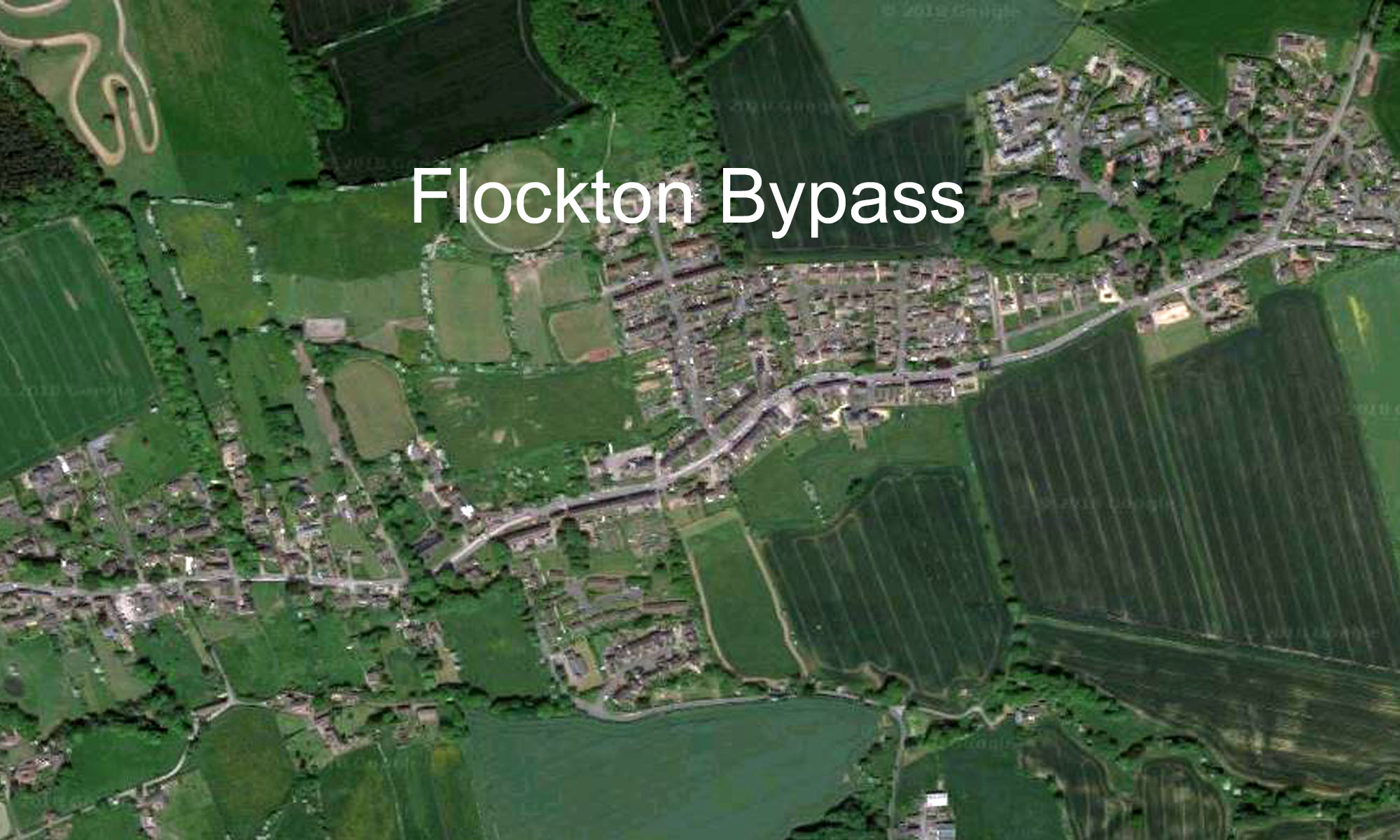
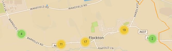 Number of Flockton listings as of 9 July 2020
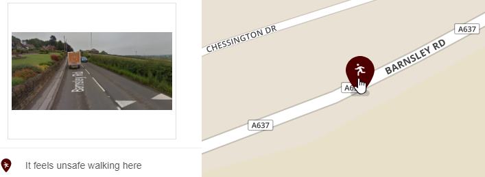 Example of adding a google street screen capture
Views: 73